UPDATE
March 16, 2021
Apple Maps now displays COVID-19 vaccination locations
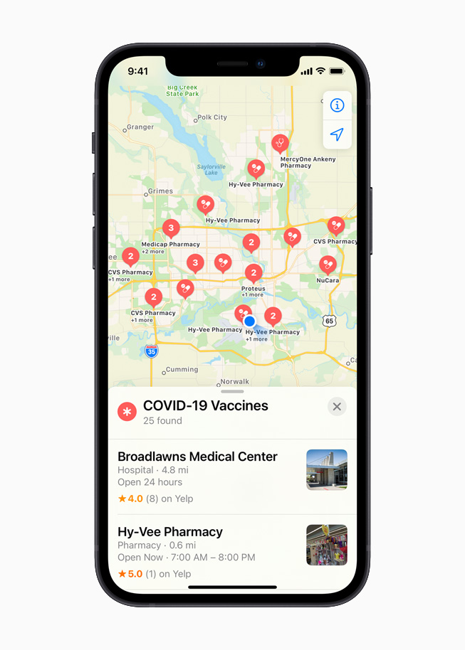
Ask Siri or search within Apple Maps to find nearby COVID-19 vaccine providers throughout the US, with operating hours and links to important information
Apple today updated Apple Maps with COVID-19 vaccination locations from VaccineFinder, a free, online service developed by Boston Children’s Hospital that provides the latest vaccine availability for those eligible at providers and pharmacies throughout the US. Users can find nearby COVID-19 vaccination locations from the Search bar in Apple Maps by selecting COVID-19 Vaccines in the Find Nearby menu or by asking Siri, “Where can I get a COVID vaccination?”
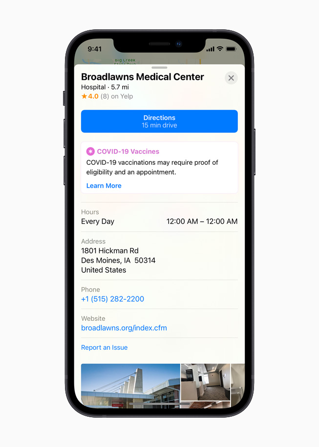
The Apple Maps placecard for each vaccine site will include the operating hours, address, phone numbers, and a link to the provider’s website, where Maps users can learn more about available vaccines and book appointments. The initial rollout includes more than 20,000 locations, with Apple adding more sites in the coming weeks.
Along with the data provided by VaccineFinder, healthcare providers, labs, or other businesses can submit information on COVID-19 testing or vaccination locations on the Apple Business Register page. Once validated, Apple may display information about the testing or vaccination locations to people using Apple services such as Apple Maps.
The update is the latest effort from Apple to help users better navigate the pandemic and take the proper steps to protect their health. Apple Maps also features:
- COVID-19 testing locations: Last year, Apple updated Apple Maps to display COVID-19 testing sites in Australia, Canada, France, Germany, Japan, the Netherlands, New Zealand, Portugal, Singapore, Taiwan, Thailand, and the United States.
- Local business updates: Apple Maps now displays COVID-19 modules on the business placecards for more than 4,400 locations, allowing retailers to communicate COVID-19-related information to their customers, like special shopping hours.
- Siri knowledge about COVID-19: In addition to helping users find nearby testing sites and vaccination locations, Siri can quickly identify outdoor dining options or provide a list of nearby restaurants offering takeout. Siri Audio Briefs help users receive the latest news and information about the pandemic through short podcasts from trusted news providers, and Siri can also provide guidance and resources from the CDC if asked, “How do I know if I have coronavirus?”
Additionally, Apple released a mobility data trends tool from Apple Maps to support the impactful work happening worldwide to mitigate the spread of COVID-19. This mobility data may provide helpful insights to local governments and health authorities, and may also be used as a foundation for new public policies by showing the change in volume of people driving, walking, or taking public transit in their communities. To learn more about COVID-19 mobility trends, visit apple.com/covid19/mobility.
Apple Maps and Privacy
Apple built privacy into the core of Maps from the beginning. Data collected by Maps, like search terms, navigation routing, and traffic information, is associated with random, rotating identifiers that continually reset, so Apple doesn’t have profiles of users’ movements and searches. This enables Maps to provide a great experience, while protecting user privacy.
Share article
Images of Apple Maps

